Explore Greece Plan your trips Take your trips with you Experience & visit places in 360 images and videos
Let us guide you!
Are you travelling in Greece but don't know where to start? Do you want to plan your trip?
What is Dimoleon
Dimoleon offers a trip planner and mobile argumentative application that will guide you every where around your trips
Our picks
Most liked places
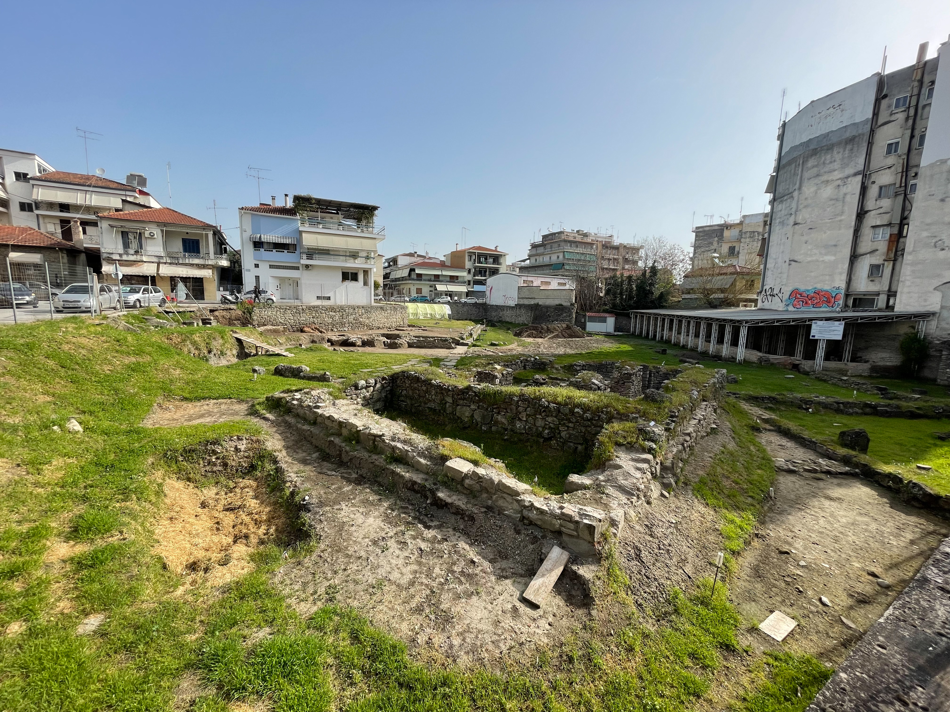
Archaeological Site of Ancient Trikke "Asclepieion"
Ancient Trikki, an important city of the Thessalian tetrarchy of Estiaotida, sprawled between the Lithaios river – which still crosses today’s modern city – and on the hill “Kastro” where probably the ancient citadel was. In the city there was one of the oldest medical centers of Asclepius, that ancient Trikki was known in antiquity. The earliest proof about Trikki is in the Homeric List of Ships, which mentions that the city participated in the expeditionary force of the Greeks in the Trojan War with 30 ships and leaders of the two sons of Asclepius, Mahaonas and Podalerios, who had been taught Medicine by their father. For the beginnings of the city of historical times the excavations are poor and the written sources sparse.
The earliest confirmed excavation of the city dates back to the Bronze Age and is located in the area of the present archaeological site of Trikala.
In test sections there was found ceramics indicating that the western slopes of the ancient acropolis had been inhabited since the Early Bronze Age (3300 BC) until the Mycenaean era. Unfortunately, there are not architectural remains. Ceramics that were found in test sections, indicates uninterrupted habitation from the early geometric years to the classical times.
The connection of the city with Asclepius – the antiquity of the city was known as «αρχαιότατον και επιφανέστατον» (“ancient and prominent”) according to the geographer of the 1st century. B.C. Strabo – gave Trikki a special radiance in Greece. Today, the largest part of the ancient city is covered by the homonymous modern city, as its habitation has been uninterrupted until nowadays.
The archaeological excavation began to bring to light and reconstruct the image of ancient Trikki from the late 19th century, when (following the excavation of the Asclepius of Epidaurus) the researchers were interested in the revelation and the same name of the ancient Asclepius of Trikki. The archaeological excavations that were carried out on the site on adjacent, private plots from 1902 to 1992 had a rescue character and brought to light three buildings of early Roman times and one belonging to the Byzantine period.
Place
Trikala,Trikala
About
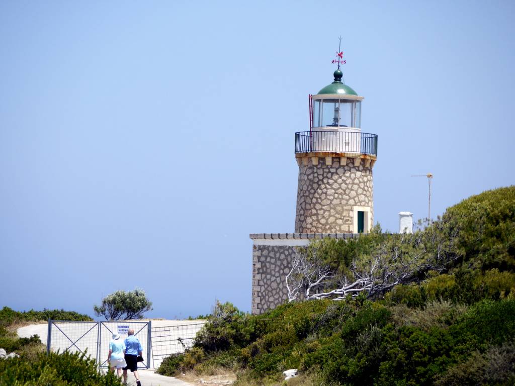
Korithi Lighthouse
If you find yourself at The Cape of Korinthi you must visit the stone lighthouse. The lighthouse was built back in 1897 and stands tall at 9.5 meters. From here you can gaze out at the endless blue sea and see as far as Kefalonia. Not far from here you can also take a boat to the shipwreck and blue caves, they leave every 10 minutes. While en route you will pass by numerous outdoor vendors that sell local traditional products.
Place
About
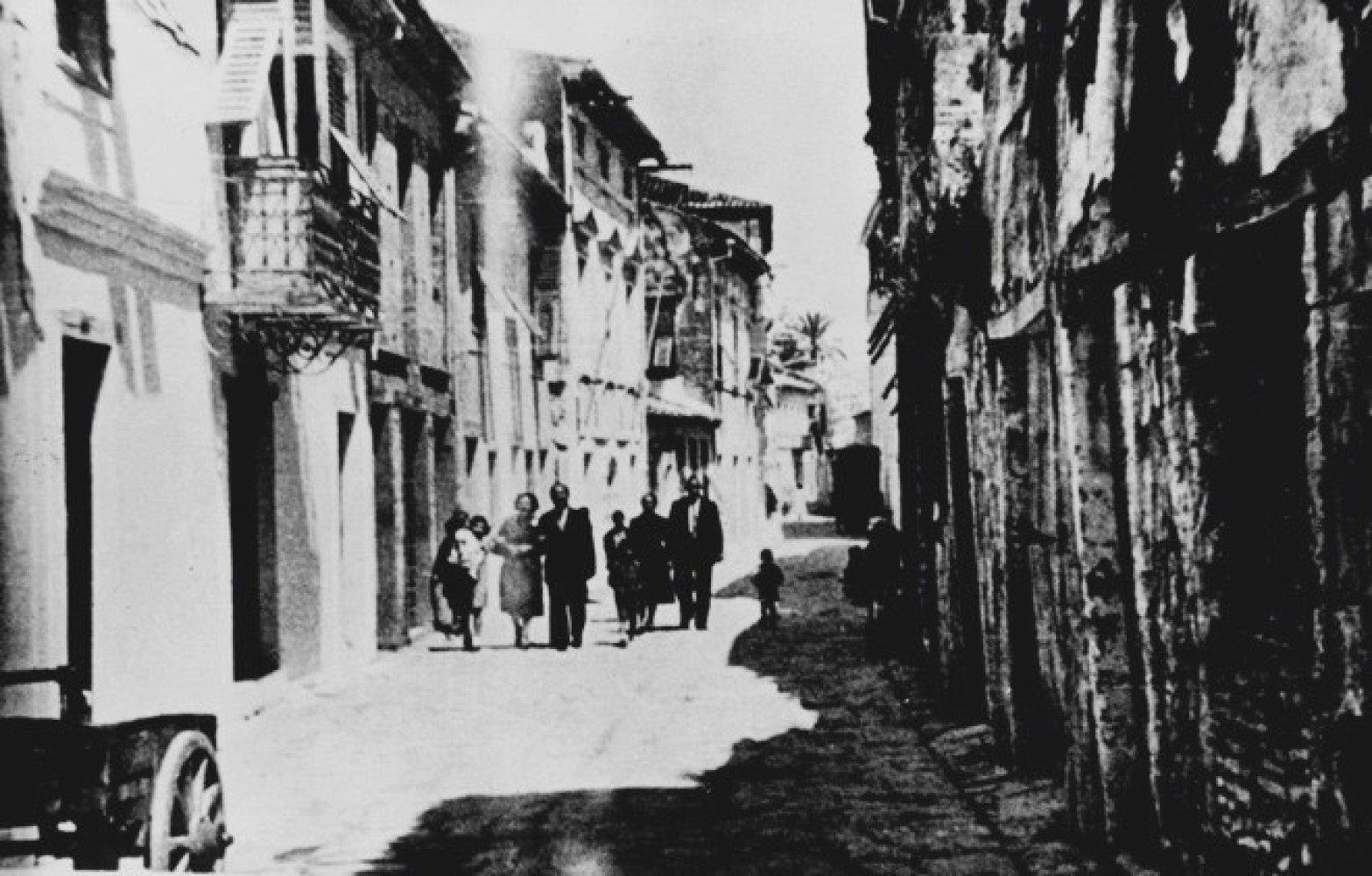
Jewish ghetto
The Jews of Zakynthos were confined to the Ghetto after the events of 1712.
In that year, the "Jewish" events took place in Zakynthos, a pogrom against the Jewish community after a "blood libel" with the alleged victim being the five-year-old Ioannis Anastasiou Zervos. Whose, indeed, "martyr John Zervos [. . . ] which is now preserved in a box in the altar of the divine Church of the Estavromenos in the city of Zakynthos and which is revered by all as a holy relic", as noted in a treatise on the Jews by the brother of the music composer Paul Carrer, Frederick, who, in explaining the real causes of the pogrom, states that "at that time they [the Jews] practiced usury to such an extent that the Venetian government was forced to put a stop to this great evil".
The streets of the Ghetto formed a cross. The end of each of these four streets was closed with an iron gate.
The gates were closed at sundown and all communication between the Jews and the city ceased.
The walls and gates were demolished after the union of the Ionian Islands with Greece.
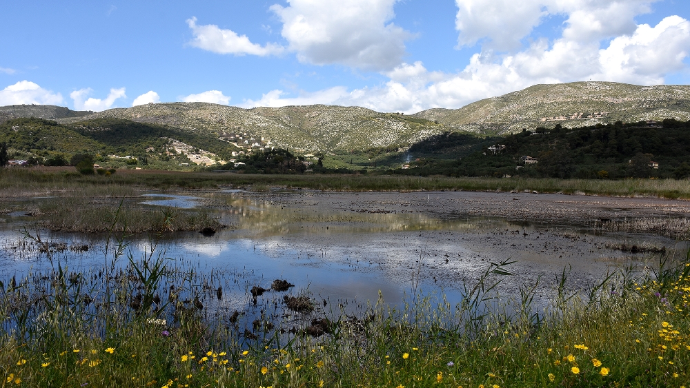
Rassou Pond (Anemomilos Marsh)
Shallow seasonal lakelet. It is protected under the Presidential Decree for the small insular wetlands (Y222KER011, ΦΕΚ 229/ΑΑΠ/2012). The vegetation on the banks consists mainly of Chaste Trees and bulrushes. There are several Epeirus Water Frogs. Common Moorhens and Little Grebes breed here, while various species of ducks and the Eurasian Coot often observed. The foreign Myocastor has appeared in the wetland recently.
Place
Corfu
Marathonisi Island
Marathonisi the small privately owned island has been designated as a nature protection area due to the spawning of the Sea turtle Caretta Caretta on its sandy beaches. Within the bay of Laganas, where is located, it is protected by the National Marine Park of Zakynthos (ETHPZ).
Outdoor Activities
With so much to do and see in Greece, the opportunities are truly endless. Check any activities that you might like and plun your trip.
From Lakka to Loggo
From Lakka to Loggos: Lakka - Aronatika - Grammatikaiika - Rantatika - Loggos
The walker’s orientation and safety is solely their responsibility. The present report, the relevant tracks (gpx) and the rest of the informational material are just supplementary. The proper equipment is necessary, depending on the weather conditions and the nature of the route.
Route’s type: linear
Route’s duration: 2 hours
Route’s length: 6,500 metres
Level of difficulty: easy
Suggested season: all seasons, weather permitting
The route
The route starts from the settlement of Lakka, from where a beautifully landscaped path begins over the western beaches of the settlement, where the walker enjoys the view of the beautiful homonymous bay. A landslide has occurred at one point and increased caution is required. After about 700 metres the path meets a concrete road, which is followed south going uphill. The road passes through olive groves, in a largely shady environment, dotted with beautiful buildings. We continue along the same road for about two kilometres and after passing Aronatika, we follow the path that continues along a wall of privately owned land (there are signs).
From this point we very soon reach the wonderful and unique bay of Ipapanti with its vertical cliffs and caves. The view of the bay, which requires increased attention, is breathtaking. There, apart from the vertical rocks and the bay in the background, we enjoy the endless blue of the Ionian Sea. We then head towards the area of Rantatika and the enchanting and evocative site of the church of Ipapanti through a pretty downhill path. The area is shady and overgrown with olive trees, cypresses and other vegetation.
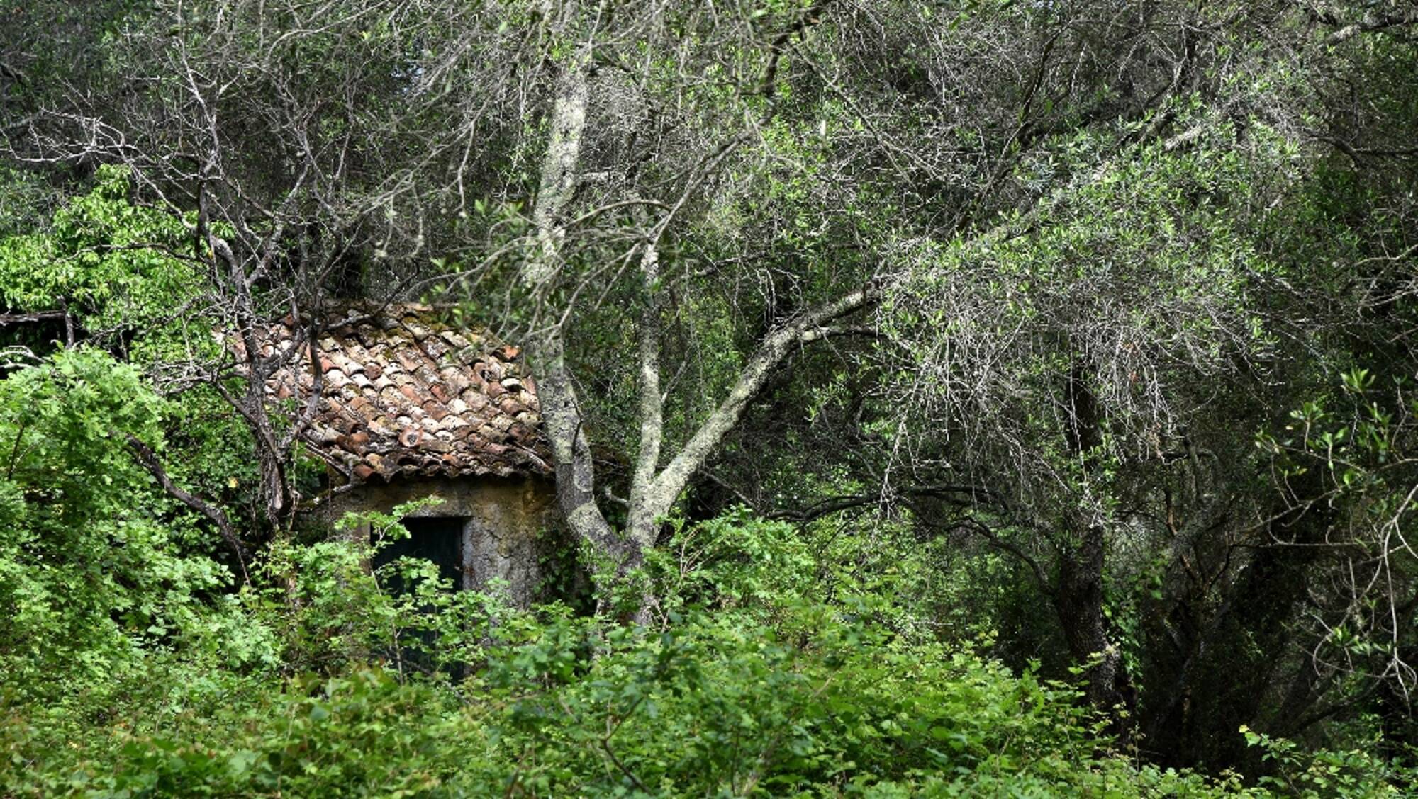
After passing Rantatika, we continue our downhill course through the lush vegetation of the ravine and after passing the stream (which doesn't present any difficulty) we climb up the stone cobbled road towards Loggos, where we meet the main asphalt road. At the junction we see the old English tank of 1862 and continue our slightly downhill course from the main asphalt road which leads us to Loggos. At some point, we take a short detour, taking a shortcut through a path, which takes us back to the central asphalt. Less than a kilometre later, we find Loggos with its beautiful beaches, its welcoming shops and the evocative ruins of the old soap factory.
In Paxos there is: Health Centre, Police Station and Citizen Service Centre (KEP).
Lakka
Lakka is a settlement in the North of Paxos. It is nestled at the bottom of a sheltered bay, popular with boats of all kinds for the safety it offers. It takes its name from its Souliotes inhabitants, who, persecuted by Ali Pasha of Ioannina, fled to Paxos.
In its streets you will find small picturesque stone houses. It is surrounded by green hills and has very nice beaches, such as Monodentri and Harami beach. Near Lakka there are also very interesting sea caves. Among them is the most remarkable cave of Hypapanti. Among the sights of the settlement is the Byzantine church of Ipapanti, which dates back to 1600. The church has an impressive bell tower and a well-crafted iconostasis. Also worth visiting is the stone lighthouse, which was built in 1832, is 36 metres high and rises 108 metres above sea level.
Loggos
Loggos is a small, but very picturesque settlement of Paxos, nestled in pine trees and olive trees. It is 5 km away from Gaios and has about 200 inhabitants.
From the harbour of Loggos, we can, by renting a small boat, navigate the turquoise beaches of the island and its sea caves. Very close to Longos are the exceptional beaches of Levrechio, Marmari, Kipos and Kipiadis.
At the edge of the settlement dominates the old oil and soap factory of Anemogiannis, next to the primary school. It is also worth visiting the church of Zoodochos Pigi, whose existence is mentioned since 1739, in order to admire its hagiographies.
Every year in the first days of September, Loggos hosts a particularly interesting classical music festival.
Anemogianni Soap Factory in Loggos
On our left hand, as we face the harbour of Loggos, we find an imposing ruined building, which is now being repaired. It is the old soap factory of the brothers Stefanos and Ioannis Anemogiannis. It was first operated at the end of the 19th century as an oilseed processing factory, unique in the Balkans in terms of size and equipment. In 1932, under the leadership of Spyros Anemogiannis, a chemist, the expansion of the factory began, which evolved into a soap factory. In its peak, the factory employed 60-70 workers. In the 1960s, after two fires, the factory began to decline. It was finally closed in the 1980s.
Location
Paxos Island
Trekking route
Coordinates
39.19927443 - 20.16723864
In the beautiful forest
In the beautiful forest: A circular route in the forest of Kalafationes
The walker’s orientation and safety is solely their responsibility. The present report, the relevant tracks (gpx) and the rest of the informational material are just supplementary. The proper equipment is necessary, depending on the weather conditions and the nature of the route.
Route’s type: circular
Route’s duration: one hour and twenty minutes
Route’s length: 4.000m
Level of difficulty: easy
Suggested season: all seasons, if weather conditions permit it. It is recommended to avoid rainy days or the days afterwards.
The route
The route starts from the parking area of the settlement and after walking through the beautiful settlement we reach the central square. There we have to be careful to take the right cobbled path leading to the trail. It is the small downhill, to the north - northeast, next to the large cobbled path. After walking a little more on the outskirts of the settlement, take the path north-northwest. The path is not marked but now and then we find a yellow wooden sign with a hedgehog. The trail passes through lush vegetation providing a dreamy shady environment. The trail is accompanied, in many places (especially at the beginning), by a stream that makes it muddy and therefore slippery. On days after rain it may be difficult to cross.
Since the path is not marked, caution is required at junctions in order to maintain our direction. When the downhill path ends, we come across a narrow stream which is easily passed. After this the path becomes uphill, we meet a dirt road, which we take on the uphill side until the moment we meet a gate and next to it the path starts uphill again, which becomes very steep on the way. At its end, the path meets an asphalt road, which joins the main road of the settlement, where after passing the interesting area with the wells, we head to the starting point of the route, the parking area.
On the island of Corfu there are:
Citizen Service Centres in the settlements (from north to south): Sidari, Acharavi, Kassiopi, Ypsos, Paleokastritsa, Corfu Town, Achilleion, Moraitika, Argyrades and Lefkimmi.
Police stations in the settlements (from north to south): Karousades, Paleokastritsa, Corfu Town and Lefkimmi.
Numerous private medical offices, medical centres and pharmacies, while public health structures exist (from north to south): the Avliotes Regional Medical Centre, the Acharavi Regional Medical Centre, the Agios Athanasios Health Centre, the Hospital and Emergency Centre in Corfu Town, and the Lefkimmi Health Centre,
Kalafationes
Kalafationes are located in Middle Corfu, 9 km from Corfu town and at an altitude of 182 m., between a dense olive grove and a virgin forest of chestnut trees. It has 461 inhabitants (2011 census). It is a designated traditional settlement. Walking along its traditional cobbled streets, you will admire the folk architecture of the houses and enjoy the hospitality of the inhabitants in the traditional cafes.
The history of the settlement dates back to ancient times. Evidence for this, is the existence of ancient settlements in the wider area (Kamara, Kouramades, Kastelanoi, etc.), but also the fact that the calcite found on the hills of Kalafationes and Varypatades was used in antiquity for the construction of the columns and the epithelium of the Doric Temple of Kardaki. It suffered, like other villages on the island, great destruction during the invasion of Barbarossa in 1573. The name of the settlement "Kalafationes" comes from the work of reed drilling, which was the livelihood of many of its inhabitants, either by waterproofing boats or, probably, barrels.
In Kalafaties it is worth visiting the modern equestrian club, where riding and therapeutic riding lessons are held, as well as the tzitsibira factory, the only one that still produces this traditional soft drink, a relic of the British rule on the island. In the wider area there are five churches, Agios Ioannis (in the area of Gerama), the Church of Prophitis Ilias, The churches of Agios Ioannis (in the centre of the village) which is the metropolitan church of the village, Panagia (also in the centre of the village), Agioi Pantes (in the south-eastern edge of the village) where it has been moved and currently is functioning as cemetery, and Agia Marina (in the district of Kothoniki).
The neighbouring villages are Varypatades, Kouramades, Viros and Kastellani of Mesi.
Kobitsi Forest
Just a few kilometers away from Corfu town, the village of Kobitsi is located at the top of a hill with a panoramic view of Peleka, the lagoon of Halikiopoulos and the mountain of Agioi Deka. In Kobitsi there are the mansion of the homonymous family, the high bell tower in the church of Agioi Apostoloi and the restored Venetian fountain.
Just outside the settlement there is a beautiful forest with pine and chestnut trees, an ideal place for a walk on foot or by bicycle through the lush vegetation and wild flowers, accompanied by the chirping of birds.
Varipatades
It is one of the most beautiful settlements, belonging to the municipal unit of Achilleion. It is located next to Kalafationes. It is a designated listed settlement, built on the slopes of a hill, the top of which is covered with olive and cypress trees.
Walking along the cobbled streets of Varipatades, we will admire the tall mansions with pastel colours and Corfiot beige tiles, the traditional houses, built almost one on top of the other, the small traditional square, where the church of Agios Stefanos is located.
In Varipatades, a unique custom is revived on the evening of Holy Friday: Hundreds of snail shells, the so-called "boboloi" are made into lamps, with cotton wicks in oil, and placed lit all along the route where the Epitaph passes, creating an extremely solemn atmosphere.
Location
Corfu Island
Trekking route
Coordinates
39.59516109 - 19.87060912
From the beach to the lake
From the beach to the lake: Kavos - Panagia Monastery - Moschopoulos Lake - Kavos
The walker’s orientation and safety is solely their responsibility. The present report, the relevant tracks (gpx) and the rest of the informational material are just supplementary. The proper equipment is necessary, depending on the weather conditions and the nature of the route.
Route’s type: circular
Route’s duration: 2 hours
Route’s length: 6,400 m
Level of difficulty: easy
Suggested season: all seasons, if weather conditions permit it
The route:
The route starts from the outskirts of the settlement from a three-way road on the way to Spartera. The route is heading south on the asphalt road which we leave at the first crossroads (about 100 meters later) and head south towards the road, which becomes dirt on the way. The road is driveable but with many problems and is not recommended for public vehicles especially after the junction for the beach of Arkoudila. We continue eastwards, where after crossing a plateau we head towards the ruins of the monastery.
The route is smooth, with adequate shade and very beautiful views of southern Corfu and the Ionian Sea, up to the imposing ruins of the Monastery of Panagia. From this point the road becomes a gentle downhill path through lush and completely shaded surroundings.
The smooth downhill continues until the trail crosses the side stream, the crossing of which is not a difficult task because it is quite narrow and without much water. From the creek onwards the trail becomes uphill and in the last small part (before the road) it becomes very steep and requires increased attention.
After the junction with the road, which leads to the beach, the path continues gently uphill without any problem until the top of the hills that offer excellent views of South Corfu and the Ionian Sea. From here, a smooth downhill path begins until the artificial lake of Moschopoulos. Once we approach the lake it is recommended to follow the southern route over the lake as it offers excellent views towards it. From the lake and beyond, a dirt road, which later becomes asphalt, the road leads to the starting point of the trail.
On the island of Corfu there are:
Citizen Service Centres in the settlements (from north to south): Sidari, Acharavi, Kassiopi, Ypsos, Paleokastritsa, Corfu Town, Achilleion, Moraitika, Argyrades and Lefkimmi.
Police stations in the settlements (from north to south): Karousades, Paleokastritsa, Corfu Town and Lefkimmi.
Numerous private clinics, medical centres and pharmacies, as well as public health structures (from north to south): the Avliotes Regional Medical Centre, the Acharavi Regional Medical Centre, the Agios Athanasios Health Centre, the Hospital and Emergency Centre in Corfu Town, and the Lefkimmi Health Centre.
Arkoudilas
Arkoudilas is a forest area of southern Corfu. It is located above Cape Asprokavos or Cavo Bianco. The name Arkoudilas was probably taken from the bear tree that abounded in the area and not from bears, which are unlikely to have been present in the area. Another version tells us that the name probably came from a corruption of the word Akrodilon, which was the name of Cape Asprokavos in ancient times. The forest of Arkoudila occupies an area of about 250 acres with very rich vegetation (cypresses, skinnias, arbutus, etc.). During the Venetian occupation it was given to the Quartano family by the Venetian Senate as a tithe.
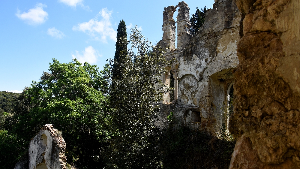
Monastery of Panagia
The Monastery of Panagia Arkoudila is built in the forest and on the top of the hill. The monastery includes the katholikon, built in 1700, according to the carved coat of arms on the bell tower. The bell tower of the church is baroque style and follows the type of Corfiot church architecture. On the right side of the bell tower there is a wall (Mantra) and on the left side there is a kind of fortification (battlements).
Then as an extension of the enclosure there is a two-storey turreted building called DURIS, probably from the English TOR, which means tower. It is located in such a position that it served as a fortress and protected the area from raids by pirates and other invaders. The upper part of the DURI was, as is evident from its construction, the living quarters of the owners or monks, and had a fireplace. The ascent and descent was made by a stone staircase, and there was a wooden catapult protecting it. The ground floor was used as a food store. On the eastern side of the tower, on the upper floor and next to the fireplace, there was a secret tunnel with steps leading to the beach under the hill, apparently for the evacuation and rescue of the monastery's inhabitants in case of danger.
On the north-western side there was a two-storey building with a two-sided staircase construction (Botso), which was the main entrance. The building was used for the accommodation of pilgrims on the day of the celebration of the 15th of August (Assumption of the Virgin Mary), which was celebrated by the monastery, and as the owners' residence. On the north side of the church there is an old stone well.
The Monastery of Arkoudila today is ruined and abandoned.
Kavos
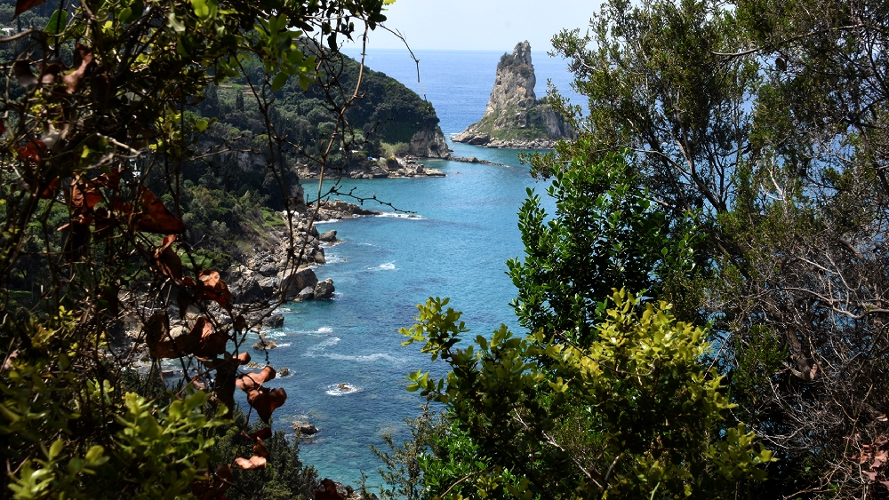
Kavos is a seaside settlement at the outermost point of Corfu, in Lefkimmi, at a distance of about 45km from the town. It was the cavo bianco of the Venetian period, literally the white cape. Off its beach, between Corfu and the mainland coast, the famous naval battle between the Corinthians and Athenians in the Peloponnesian War took place. Kavos is today a tourist destination. Some years ago there were only a few houses among olive trees, few inhabitants and nothing else. Today it is one of the most touristic places in Corfu. It is distinguished for its intense nightlife and as a popular destination. It has an equipped beach with shallow clear waters.
From Kavos one can make daily excursions to Sivota of Thesprotia, Paxos or even Parga. The beach of Arkoudila stretches just below, with access from a dirt road in the Kavos area, while we can also go from its western side to the spot where the locals call it Mikronisi. They are essentially two beaches joined together where they are separated by only a small rock with an arch in the middle. The landscape is magnificent, there are wonderful geological formations of clay deposits, wildly eaten by the elements landscape with precipitated slopes, bushes on the edge of the hill but also a great biodiversity, from ants, butterflies, turtles, scorpions, snakes, insects, as well as turtles Caretta - Caretta.
Location
Corfu Island
Trekking route
Coordinates
39.36568154 - 20.10191436
Cephalonian Fir
Cephalonian Fir Abies cephalonica is a Greek endemic species, growing naturally only in Greece. It was first described as a new species by the English botanist JW Loudon in 1838. This together with its phytogeographical importance were the main reasons Mt.Aenos was declared a National Forest in 1962.
At Ai Gordis
At Ai Gordis: Pentati - Agios Gordios
The walker’s orientation and safety is solely their responsibility. The present report, the relevant tracks (gpx) and the rest of the informational material are just supplementary. The proper equipment is necessary, depending on the weather conditions and the nature of the route.
Route’s type: linear
Route’s duration: 50 minutes
Route’s length: 2.000 metres
Level of difficulty: very difficult
Suggested season: all seasons, if weather conditions permit it
The route
The route starts from the courtyard of the church of Panagia Odigitria. We open the door and enjoy the excellent view from the balcony in front of the church. Then we descend the large staircase with many steps and reach the centre of the village. Following the main road to the north we come across a crossroads where there is a sign marking the start of the path.
The trail is slightly downhill, but gradually steep slopes of the ground appear on our right, requiring increased attention (cliff). Shortly afterwards, a large subsidence, created by the recent winter rains, causes a large hole about a metre deep, cutting off the path. Crossing the hole, given the existence of the cliff, requires attention and increased skills. The trail after the subsidence continues intensely downhill and also requires increased caution.
Along the way we encounter a landslide (also caused by recent rains) that has created a sara (a steep slope under a cliff, covered with gravel, stones and rocks falling from it). This area also requires increased attention and special skills. It should be noted that the crossing of a sara should be done, as far as possible, horizontally, which in our case is particularly difficult.
After the sara the path continues downhill up until the beach in front of the big hotel. We continue along the beach until the parking area of the main road of the settlement, where the trail ends.
The route passes through a lush environment, where among the trees the walker can admire the excellent view of the Ionian Sea, the islets of Tholeto (or Ortholithi) and Cape Faskia literally under his feet, while the rocks of Ortholithros stands above him. It is an impressive landscape, but the poor condition of the path prevents the walker from enjoying it as it should be.
As a linear route, the track can start from both sides/entrances: a) from Pentati as described before and b) from Agios Gordios uphill. The walker can also return back to the start of the route at Pentati.
Although the route is not more than 2,000 metres in total (one way) , the walker should estimate that it will take approximately one hour (without any stops) to complete the Pendati - Agios Gordios route, due to the increased difficulty of the route.
On the island of Corfu there are:
Citizen Service Centres in the settlements (from north to south): Sidari, Acharavi, Kassiopi, Ypsos, Paleokastritsa, Corfu Town, Achilleion, Moraitika, Argyrades and Lefkimmi.
Police stations in the settlements (from north to south): Karousades, Paleokastritsa, Corfu Town and Lefkimmi.
Numerous private medical offices, medical centres, pharmacies, and public health structures exist (from north to south): Avliotes Regional Medical Centre, Acharavi Regional Medical Centre, Agios Athanasios Health Centre, Hospital and Emergency Centre in Corfu Town, Lefkimmi Regional Medical Centre
Pentati
Pentati is a settlement in Corfu. It is located about 17 km away from the town. It is the only settlement of the municipal district of Pentati. According to the 2011 census, it has 261 inhabitants. It is built at an altitude of 120 meters and overlooks the southwest coast of the island and the famous rock Megalo Tholoto or Ortholithi. In Pentati the houses are traditional and colourful and surrounded by olive and cypress trees.
Below the village there is a small, secluded beach named Fieroula, which is covered with pebbles and rocks and its seabed is ideal for underwater exploration or fishing. It is accessed by a narrow paved road that crosses through dense olive groves that provide plenty of shade along the way. The large, popular beach of Agios Gordis is just 4km away from Pentati by car.
Agios Gordios
Agios Gordios is a small settlement in the west of the island, 20 km away from Corfu town. It is popular for its long sandy beach, with the rock of Aerostatos on the north side, which used to serve as an observatory, and 'Ortholithi' on the south, a rock that overlooks the sea, as mentioned in a story by Iakovos Polylas.
The small settlement is developed between the beach and the mountains and it is quite developed in terms of tourism. There are many houses, most of them for tourists, large hotels and shops.
Reaching Agios Gordios from above, on the only road leading to the beach, you can admire the whole bay, the settlement and the lush vegetation.
Location
Corfu Island
Trekking route
Coordinates
39.37479871 - 20.06770068
In Erikousa
In Erikousa: Porto - Fiki - Gitonies - Potamos - Porto
The walker’s/tourist's orientation and safety is solely their responsibility. The present report, the relevant tracks (gpx) and the rest of the informational material are just supplementary. The proper equipment is necessary, depending on the weather conditions and the nature of the route.
Route’s type: circular
Route’s duration: 1 hour and 20 minutes
Route’s length: 4.700m
Level of difficulty: easy
Suggested season: summer, due to sea’s limitation and ship’s winter routes
The route
Erikousa is a very beautiful and "sweet" island that has a dense network of small roads (usually concrete) and a dense network of paths, and in combination with the fact that there are very few vehicles and the distances are really short - indicatively, it is mentioned that Cape Skotini (northernmost point) is at a distance of 2800m from Cape Stamoleka (southernmost point), the walker can take any route they want through the lush nature and therefore the proposed route is only indicative.
The route starts from Porto and heads north - northwest leaving behind Porto and its beach. The route is alongside and with a view of the sea, the hill of Katergos (which has been flattened for the needs of the heliport) and the wonderful geological formations of the beach. We reach the area of Fiki and the old harbor of the island, where we will see what remains of it. Afterwards, reaching the area "Gitonies", we change direction and we head east to the lush interior of the island and the "river" mentioned on the GIS maps.
The route presents a wide variety of vegetation and view while the walker often encounters signs for paths that lead to different places. Generally, the direction is eastwards, towards the hill, where, if the walker wishes, they can modify the route slightly and climb towards the opposing settlement.
On the way we head south towards the beach and the harbor, where after a while we pass in front of the active primary school of the island and the beautifully landscaped area with the two churches. In the background is the power station for the island's needs.
Continuing parallel to the beach of Porto, we reach the starting point of our course. As a circular route it can also be done in the reverse of the suggested direction. It can also be done by car and in this sense is also offered for the disabled persons.
In the settlement of Porto there is a Community Office, a Police Station, a Medical office and a Pharmacy.
Erikousa
The second largest of Diapontia Islands is Erikoussa (Erikoússa) or Erikousa (Eríkousa), oldest name: Merlere or Merlera. According to the 2011 census it has 496 inhabitants. The highest point of the island is Santardo which has an altitude of about 130 meters.
It is located north of Corfu and it is the northernmost point of the Ionian Islands. It owes its name to the Eriki (or Reiki) bush, which grows all over the island and blooms in October. It is a green island, full of olive trees, cypresses, wild herbs and plants, with blue waters and white beaches. One of the island's main attractions is its traditional olive oil mill, which is still in full operation today. Important Erikousa’s beaches are Porto and Bragini.
Tour of Keri Lake
Keri Lake Tour: Tour of the lake and the beach of Keri
The walker’s orientation and safety is solely their responsibility. The present report, the relevant tracks (gpx) and the rest of the informational material are just supplementary. The proper equipment is necessary, depending on the weather conditions and the nature of the route.
Route’s type: circular
Route’s duration: 40 minutes
Route’s length: 2,300 metres
Level of difficulty: easy
Suggested season: All seasons, weather permitting. In summer, you should avoid midday hours.
The route
It is a slightly circular flat route around the lake. The route starts from the parking area and proceeds northwest along the dirt road. Although it is not a marked route, it is easy for walkers to follow. Alternatively, the route can be done by car, with a little attention, because the road, although it is a dirt road, for the biggest part does not present any difficulty. In this sense, the route is also suitable for people with disabilities.
The route can also be taken in the opposite direction. During the route, the walker can enjoy - observe the lake's habitat while having a constant view of the Zakynthos Marine Park and Marathonisi.
The duration of the hike (without any stops) is around forty minutes.
On the island of Zakynthos there are:
Citizen Service Centres in the settlements (from north to south) of Alykes, Zakynthos Town, Machairado and Pantokratoras.
Police Station in Katastari and General Police Directorate in Zakynthos Town.
A number of private clinics, medical centres and pharmacies, as well as public health facilities are located in Zakynthos Town, General Hospital, and Health Centre in Kallithea.
Lake Keri
It is a quite large marsh, about 1.5 km long and 800 m wide, which ends at the homonymous beach. It is bounded on the west by a mountain range to the north and by small stony hills to the east.
It used to be a malaria hotspot, especially in the summer months.
The water of the lake, which flows through the sandy shore into the sea, is usually brackish. Many marsh turtles and two species of fish live in it.
Marathonisi
Marathonisi is a small island in the Laganas Bay of Zakynthos, opposite to Marathia beach in Keri. It is included in the Natura 2000 protection programme, because it is home to Caretta Caretta sea turtles. A small monachus monachus seal has also found shelter in a small cave there, one of the many on the island.
Marathonisi has lush vegetation, two beautiful beaches, one with pebbles, from which you can swim to a huge cave, and another, a long strip of sandy beach, which the sea turtle uses to lay its eggs. All in all it has beautiful caves and crystal clear waters.
The island was inhabited until the Second World War, and today it is uninhabited and unbuilt.
Because it belongs to the Zakynthos National Marine Park, anchoring is prohibited, although it can be visited by boat. A few minutes by boat from the island, there are also the Caves of Keri, of exceptional natural beauty.
During the route, the walker will encounter QR information signs at the following points:
a) start of the route, b) in front of the "Petrines Villes" rooms, c) at the first junction, d) at the second junction, e) at the end of the route.
Location
Zakynthos
Trekking route
Coordinates
37.68538316 - 20.83344522
.jpeg)
Mon Repos Trecking route
undefined
Location
Trekking route
Coordinates
39.60693602 - 19.92536166
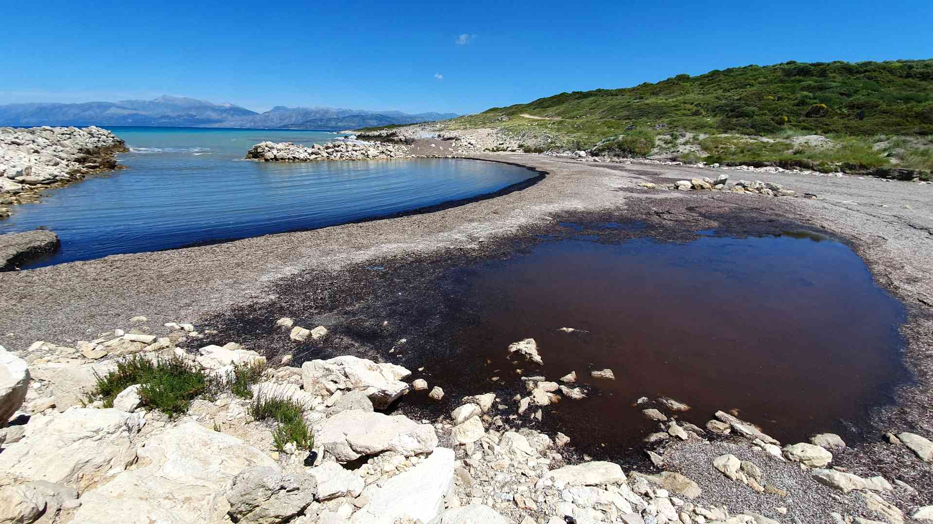
Limnothalassa Antinioti
This wetland situated on the northern coast of the island of Kerkyra (Corfu) is important for the threatened species Lutra lutra as well as for the ecological balance in the area. In addition, the site is characterized by a variety of habitats, and human activities have not yet exerted much influence upon it. This is of great importance for an island like Kerkyra which shows great tourist development and great pressure due to building construction. Source: Natura2000 viewer, European Comission.
Location
Corfu Island
Trekking route
Coordinates
39.81309029 - 19.85314331