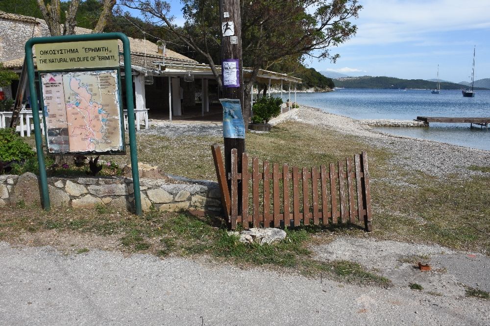
Erimitis Path
Erimitis Path: Avlaki beach - Akoli - Vromolimni - Korfovounia - Aspalathra beach - Agios Stefanos of Sinies
The walker’s orientation and safety is solely their responsibility. The present report, the relevant tracks (gpx) and the rest of the informational material are just supplementary. The proper equipment is necessary, depending on the weather conditions and the nature of the route.
Route’s type: linear
Route’s duration: 1 hour and a half
Route’s length: 4.000m
Level of difficulty: medium
Suggested season: all seasons, if weather conditions permit it
The route
Following the coastline, the Erimitis Path starts from Avlaki beach and ends at Agios Stefanos of Sinies. On this route we will walk through dense vegetation, we will meet isolated beaches, as well as three lakes, important wetlands and rare bird sanctuaries.
The route starts from the Savoura swamp and after passing Avlaki beach we climb slightly towards the next beach ("eastern" Avlaki beach which is also a nudist beach). The route takes place in a lush, overgrown and shady environment. We leave the beach behind and climb uphill towards the east - southeast. From a certain point and especially after the crossroads, where we head east, we descend, through a steep downhill that requires attention, towards the beach of exceptional beauty Akoli with the homonymous lake.
After crossing it, we head south, where we reach the Vromolimni beach with the homonymous lake. We cross the beach and continue in the shadow of Erimitis towards Korfovounia beach and then Aspalathra beach. The route continues to the edge of Agios Stefanos and ends downhill to the homonymous beach and the settlement.
It is a route of high environmental importance with intense landscape diversity and excellent views of the Ionian Sea, the island of Peristeres (or Kapareli) and the Albanian coast. As a linear route, the walker must have foreseen to have a means of transport at the end of the route (Agios Stefanos) or otherwise he/she has to return by the same route, doubling the total length of the route.
In the island of Corfu there are:
Citizen Service Centres in the settlements (from north to south): Sidari, Acharavi, Kassiopi, Ipsos, Paleokastritsa, Corfu Town, Achilleion, Moraitika, Argyrades and Lefkimmi.
Police stations in the settlements (from north to south): Karousades, Paleokastritsa, Corfu Town and Lefkimmi.
Numerous private medical offices, medical centres and pharmacies, while public health structures exist (from north to south), Avliotes Regional Medical Centre, Acharavi R.M.C., Agios Athanasios Health Centre, Hospital and Emergency Centre in Corfu Town, Lefkimmi Health Centre.
Erimitis
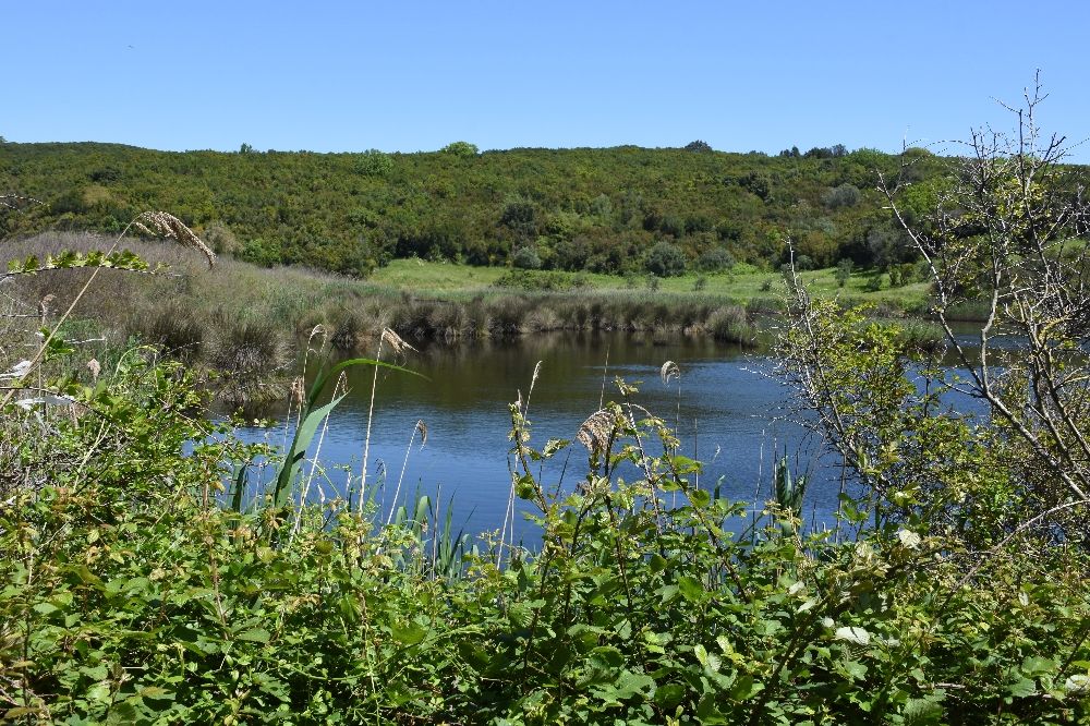
The area of Erimitis includes a continuation of six beaches, a cluster of three lakes (Savoura, Akoli, Vromolimni) and constitutes a single entity with the oldest lighthouse in Greece (1828) on the opposite nearby island, Peristeres (or Kapareli). Erimitis is accessible on foot along paths or by boat from the sea. The area is overgrown with very dense vegetation and it is practically impossible to cross it off the paths. It is a refuge for numerous rare birds (both aquatic and non-aquatic) and animals, such as the rare otter.
Vromoimni, Akoli and Savoura Lakes
Vromolimni, Akoli and Savoura are the three lakes of Erimitis that constitute an important wetland ecosystem, full of vegetation. The lakes are located very close to the sea, from which they are separated by only a narrow strip of land, and retain all their beauty and natural wealth intact.
These three lakes have been included by the environmental organisation WWF Hellas in the list of protected small island wetlands.
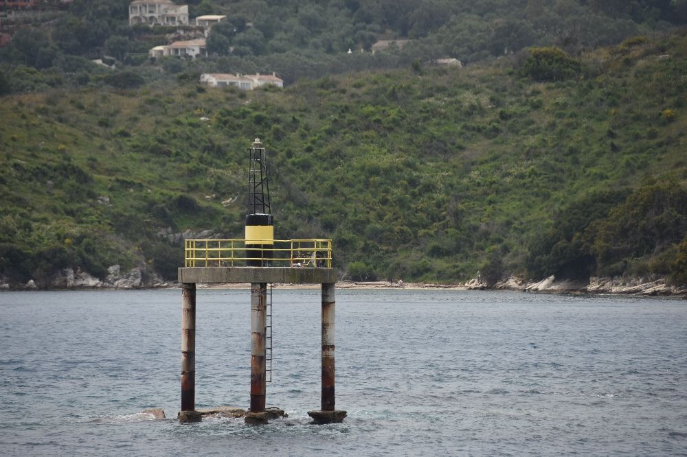
Small Island of Peristeres and its Lighthouse
The small island of Peristeres is located between Corfu and Albania and is the last boundary of the Greek maritime boundary. It divides the northern entrance of the Corfiot Sea into two parts. The western part is followed by ships sailing towards Italy, while the eastern part is followed by ships sailing towards Agioi Saranta. In antiquity it is referred to as Pythia. The locals call it "Tignozo" or "Caparelli". It has rocky ground covered with some bushes and trees. Today it belongs to the municipal unit Kassiopi of the municipality of North Corfu and according to the 2011 census it has 1 permanent resident.
Above it there is a lighthouse, which was built in 1826, during the period of the Ionian State, by the British and marks the narrow dangerous passage between Corfu and Albania. This lighthouse was first operated in 1828 with olive oil. It is the only lighthouse of the Greek lighthouse network that had permanent huge containers (pithoi) for water storage. The height of the tower is 9 meters and its focal height is 32 meters. It was incorporated into the Greek lighthouse network in 1863 with the annexation of the Ionian Islands. It is built at a height of 23.5 metres above sea level. In 1887 it was modified to emit white steady light with one red flash per minute at a greater distance. The lighthouse remained switched off during World War II and was reopened in 1945 as an automatic acetylene torch. In 1982 its lighting equipment was replaced and it operated as an automatic solar light with a characteristic red flash every 5 seconds and a 5 nautical mile luminescence.
.jpg)
.jpg)
.jpg)
.jpg)
.jpg)
.jpg)
.jpg)
.jpg)
.jpg)
.jpg)
.jpg)
.jpg)
.jpg)
.jpg)
.jpg)
.jpg)
.jpg)
.jpg)
.jpg)
.jpg)
.jpg)
.jpg)
.jpg)
.jpg)
.jpg)
.jpg)
.jpg)
.jpg)
.jpg)
.jpg)
.jpg)
.jpg)
.jpg)
.jpg)
.jpg)
.jpg)
.jpg)
.jpg)
.jpg)
.jpg)
.jpg)
.jpg)
.jpg)
.jpg)
.jpg)
.jpg)
.jpg)
.jpg)
.jpg)
.jpg)
.jpg)
.jpg)
.jpg)
.jpg)
.jpg)