Explore Greece Plan your trips Take your trips with you Experience & visit places in 360 images and videos
Let us guide you!
Are you travelling in Greece but don't know where to start? Do you want to plan your trip?
What is Dimoleon
Dimoleon offers a trip planner and mobile argumentative application that will guide you every where around your trips
Our picks
Most liked places
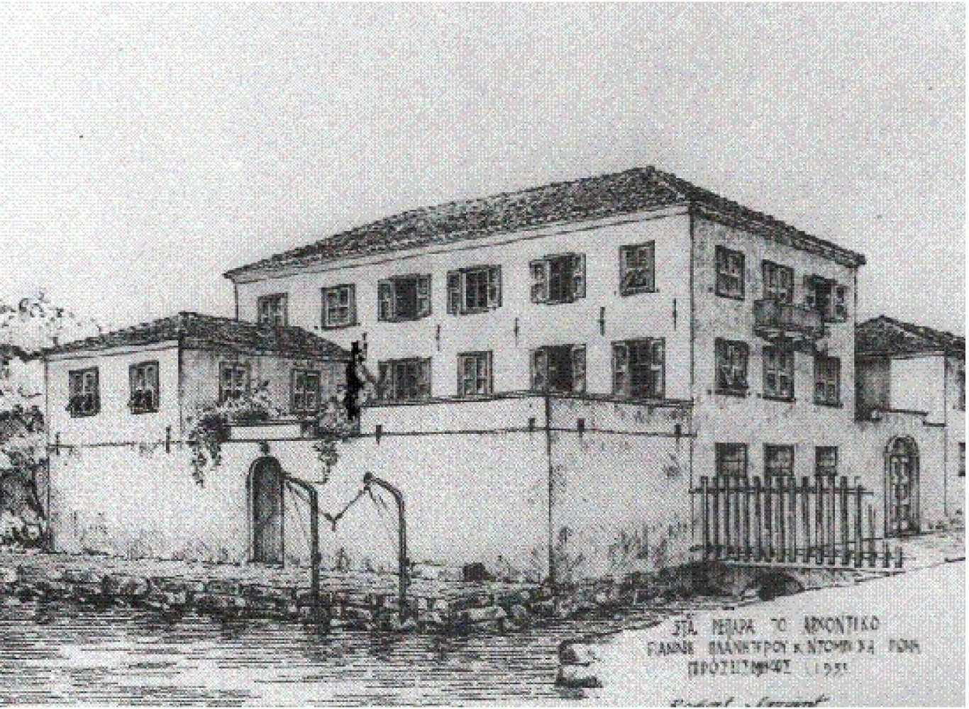
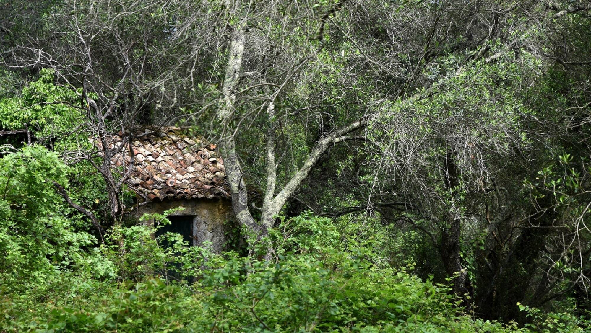
Planiterou Yoannis Mansion
Profitis Ilias chapel is possibly mentioned for the first time in 16th century. Nearby is the bust of WWII veteran, Dimitrios Loukanaris.
The view from here towards Paleokastritsa is impressive.
Place
Zante Town,Zakynthos
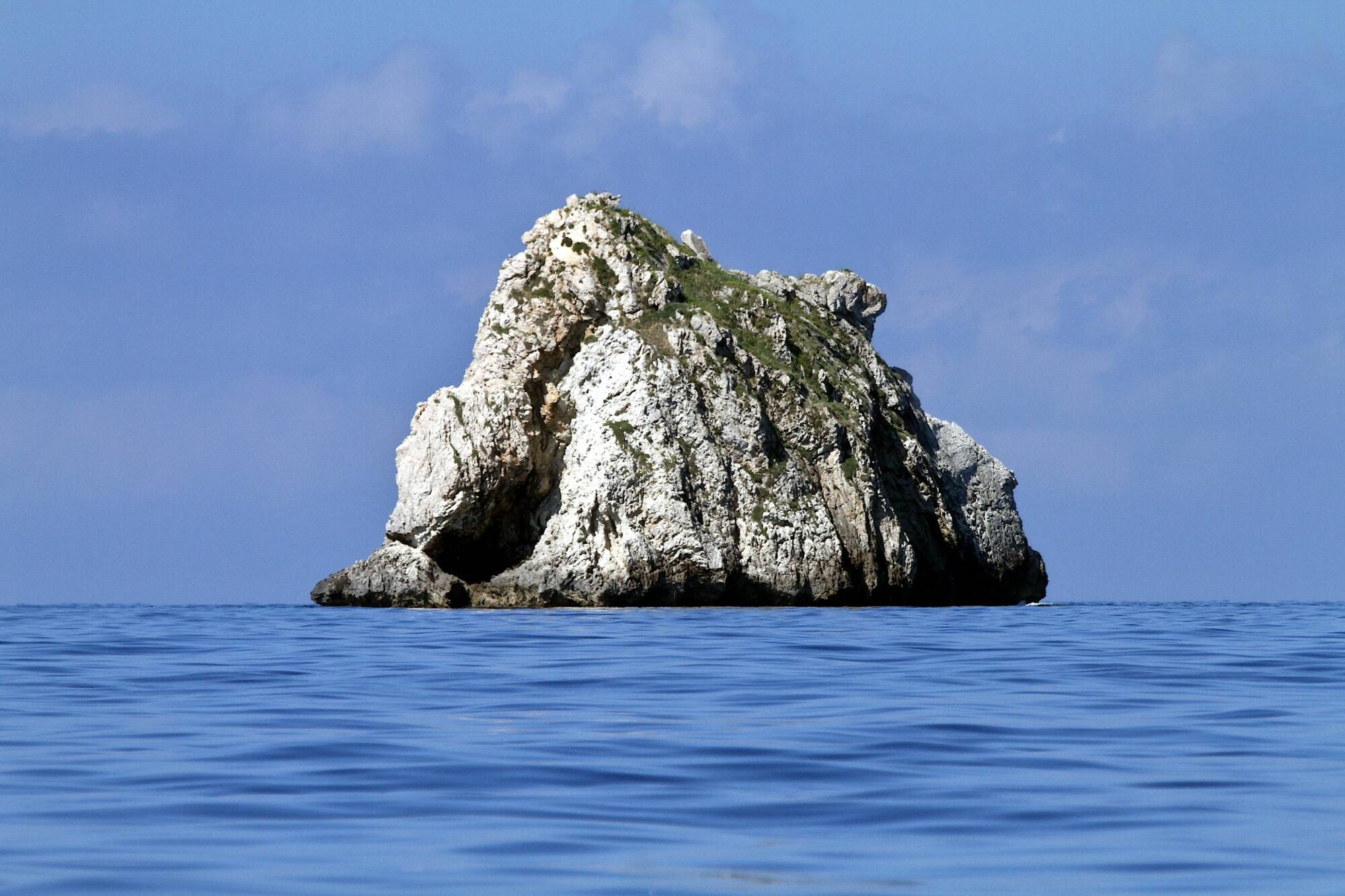
Karavi Rock
Karavi is a small steep, limestone islet located between Mathraki and Diakopo. The pointed shape of the islet is distinctive, which looks like a mismatched rock in the sea. It is one of the rocky islets that claim the 'role' of the petrified ship of the Phaeacians, which turned Odysseus into Ithaca.
Place
Diapontia Islands
Springs (well) of Herodotus
undefined
Place
Zakynthos
Valanio Rivulets (Tiflos Tributaries)
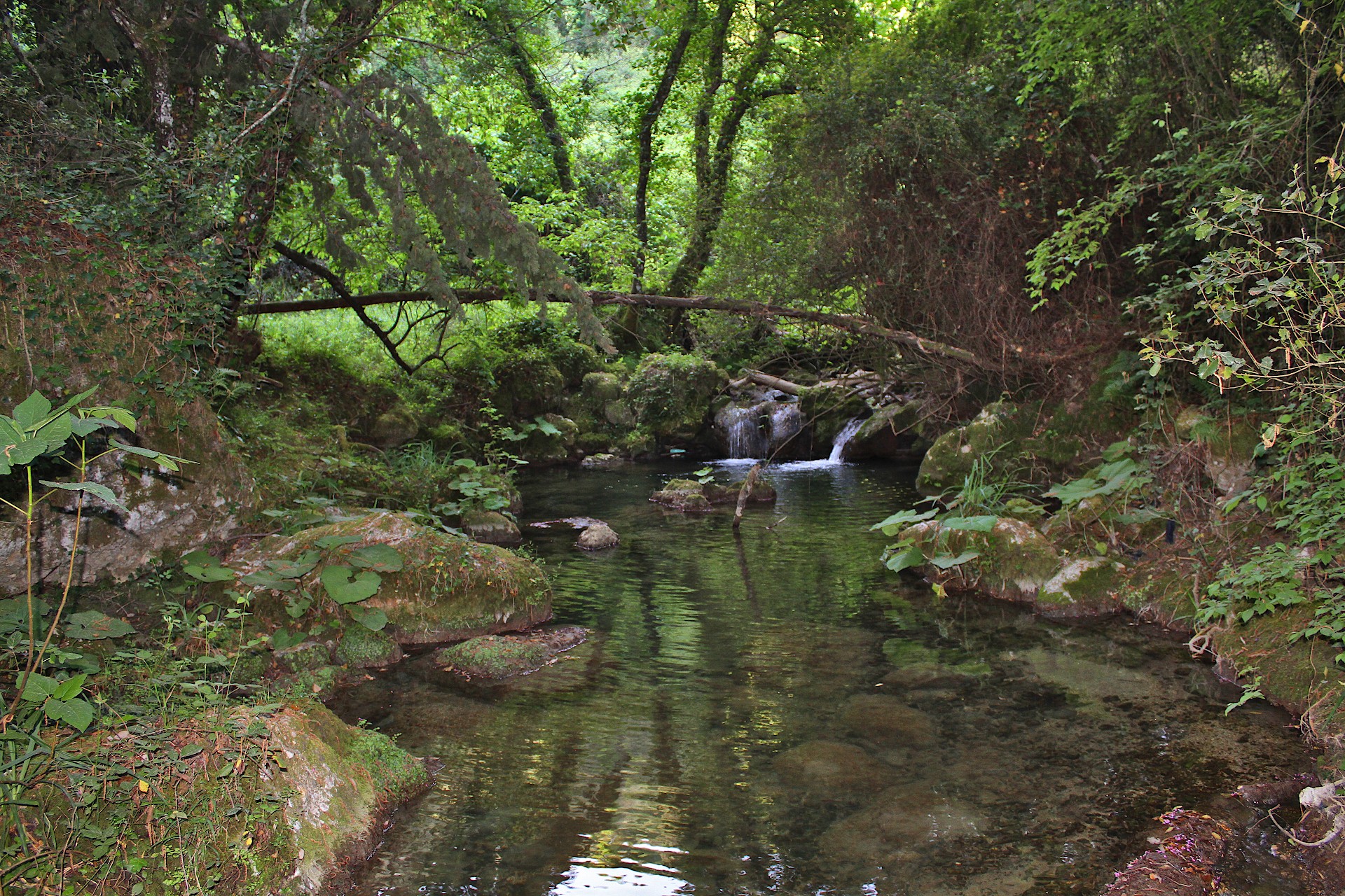
In the area of Valanio in northern Corfu, there are several branches of the Tiflos River and several springs. Among them is the main branch of Tyflos, but also tributaries that descend from Tsakalaria and Ortholithos. Further west there is also the tributary of Melissoudia. The deep valleys, the abundant greenery, the waters, the cliffs, the caves and the village of Valanio make up a unique setting, not so common for Corfu. In the small rivers live Eurasian Otters, Freshwater Crabs, Epiros Riffle Daces, Greek Smooth Newts etc. Until the 1980s the Golden Jackal was surviving in the valleys of the area and in the 1990s there were Wild Boars, while today there are still Red Foxes, Beech Martens, Edible Dormice and other species. An impressive plant of the area is the Butterbur (Petasites hybridus) with its huge leaves.
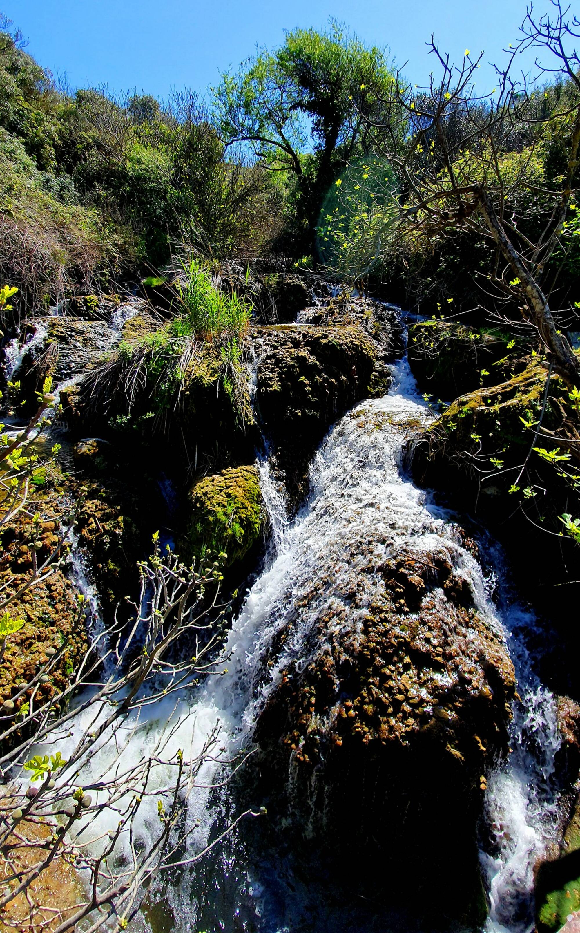
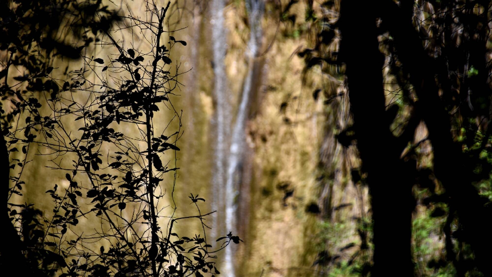
Ermones Waterfall
In the valley above Ermones, Ropa River forms a waterfall. There used to be watermills there in the past. Nowadays a small path that starts from the road of the northern access of Ermon leads to the place where the waterfalls are located.
Place
Corfu
About
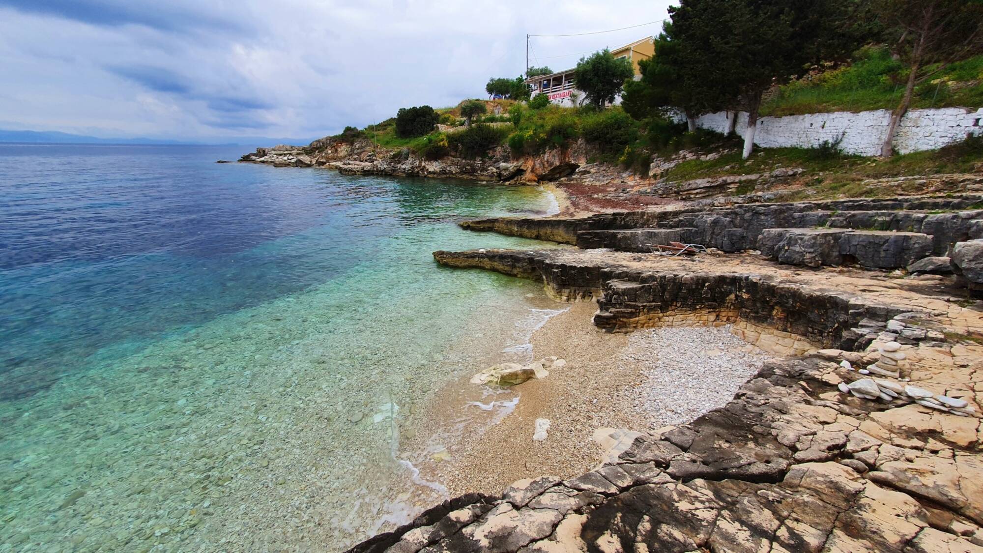
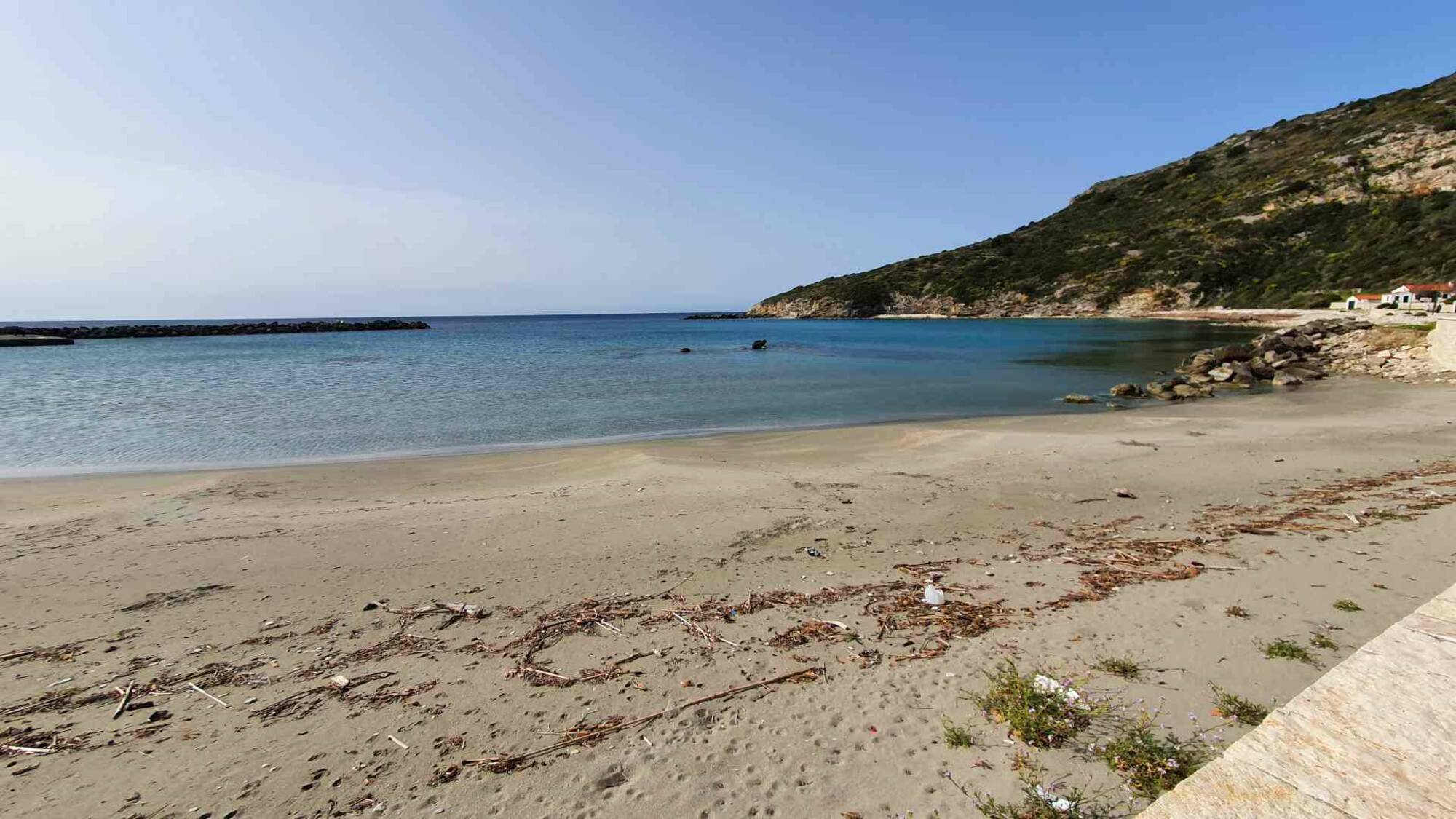
Plakes Beach
At the southern end of the settlement of Gaios, there is the small beach Plakes, with pebbles and rocky slabs.
Place
Paxi
About
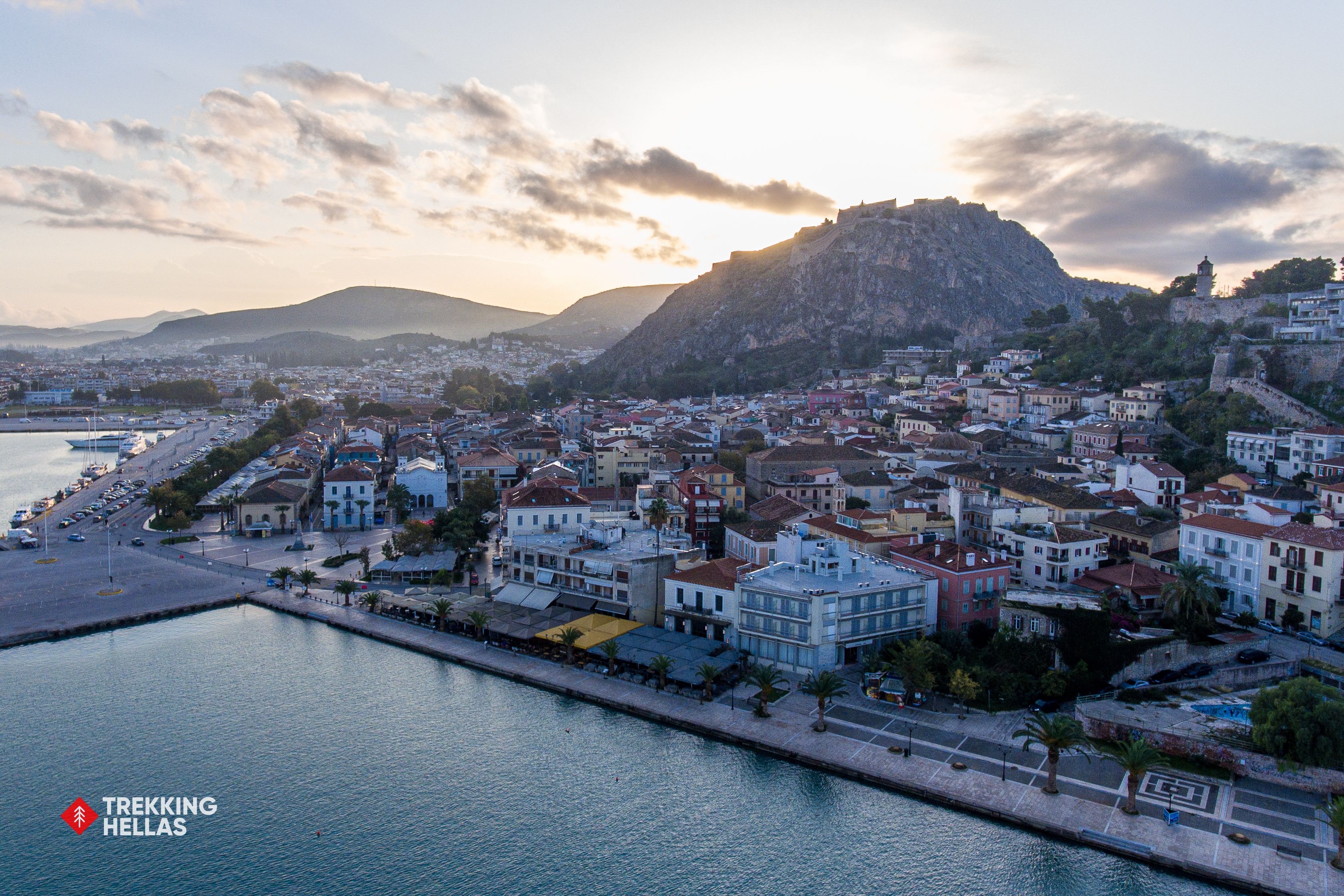
Nafplion marina
We leave behind the busy city of Athens and head to Nafplio. Nafplio, considered one of the most beautiful cities in Greece, was the country's first capital after independence and an important port since the Bronze Age. Take time to enjoy a stroll through the alleys of the town and climb the 999 steps to the legendary Palamidi Fortress to enjoy the panoramic view.
Place
Argolis,Nafplion
About
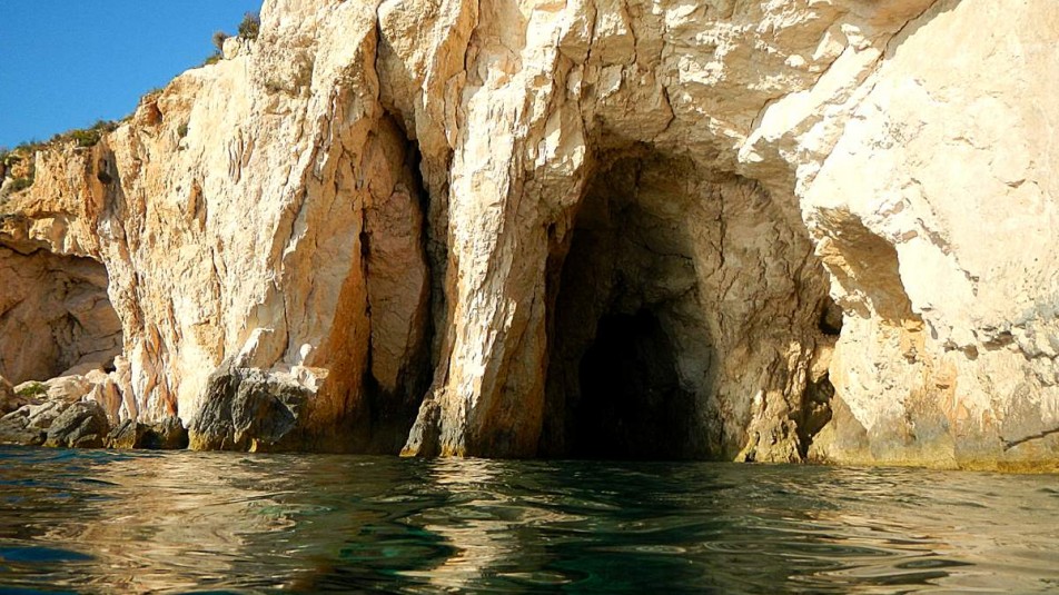
Porto Vromi
Porto Vromi is typical for its geological formations, crystal clear waters and caves to be explored. From this natural harbor boats are departing for the Shipwreck and the western caves. It is part of the Natura 2000 network along the west and northeast coasts of the island.
Place
About
Outdoor Activities
With so much to do and see in Greece, the opportunities are truly endless. Check any activities that you might like and plun your trip.
In the beautiful forest
In the beautiful forest: A circular route in the forest of Kalafationes
The walker’s orientation and safety is solely their responsibility. The present report, the relevant tracks (gpx) and the rest of the informational material are just supplementary. The proper equipment is necessary, depending on the weather conditions and the nature of the route.
Route’s type: circular
Route’s duration: one hour and twenty minutes
Route’s length: 4.000m
Level of difficulty: easy
Suggested season: all seasons, if weather conditions permit it. It is recommended to avoid rainy days or the days afterwards.
The route
The route starts from the parking area of the settlement and after walking through the beautiful settlement we reach the central square. There we have to be careful to take the right cobbled path leading to the trail. It is the small downhill, to the north - northeast, next to the large cobbled path. After walking a little more on the outskirts of the settlement, take the path north-northwest. The path is not marked but now and then we find a yellow wooden sign with a hedgehog. The trail passes through lush vegetation providing a dreamy shady environment. The trail is accompanied, in many places (especially at the beginning), by a stream that makes it muddy and therefore slippery. On days after rain it may be difficult to cross.
Since the path is not marked, caution is required at junctions in order to maintain our direction. When the downhill path ends, we come across a narrow stream which is easily passed. After this the path becomes uphill, we meet a dirt road, which we take on the uphill side until the moment we meet a gate and next to it the path starts uphill again, which becomes very steep on the way. At its end, the path meets an asphalt road, which joins the main road of the settlement, where after passing the interesting area with the wells, we head to the starting point of the route, the parking area.
On the island of Corfu there are:
Citizen Service Centres in the settlements (from north to south): Sidari, Acharavi, Kassiopi, Ypsos, Paleokastritsa, Corfu Town, Achilleion, Moraitika, Argyrades and Lefkimmi.
Police stations in the settlements (from north to south): Karousades, Paleokastritsa, Corfu Town and Lefkimmi.
Numerous private medical offices, medical centres and pharmacies, while public health structures exist (from north to south): the Avliotes Regional Medical Centre, the Acharavi Regional Medical Centre, the Agios Athanasios Health Centre, the Hospital and Emergency Centre in Corfu Town, and the Lefkimmi Health Centre,
Kalafationes
Kalafationes are located in Middle Corfu, 9 km from Corfu town and at an altitude of 182 m., between a dense olive grove and a virgin forest of chestnut trees. It has 461 inhabitants (2011 census). It is a designated traditional settlement. Walking along its traditional cobbled streets, you will admire the folk architecture of the houses and enjoy the hospitality of the inhabitants in the traditional cafes.
The history of the settlement dates back to ancient times. Evidence for this, is the existence of ancient settlements in the wider area (Kamara, Kouramades, Kastelanoi, etc.), but also the fact that the calcite found on the hills of Kalafationes and Varypatades was used in antiquity for the construction of the columns and the epithelium of the Doric Temple of Kardaki. It suffered, like other villages on the island, great destruction during the invasion of Barbarossa in 1573. The name of the settlement "Kalafationes" comes from the work of reed drilling, which was the livelihood of many of its inhabitants, either by waterproofing boats or, probably, barrels.
In Kalafaties it is worth visiting the modern equestrian club, where riding and therapeutic riding lessons are held, as well as the tzitsibira factory, the only one that still produces this traditional soft drink, a relic of the British rule on the island. In the wider area there are five churches, Agios Ioannis (in the area of Gerama), the Church of Prophitis Ilias, The churches of Agios Ioannis (in the centre of the village) which is the metropolitan church of the village, Panagia (also in the centre of the village), Agioi Pantes (in the south-eastern edge of the village) where it has been moved and currently is functioning as cemetery, and Agia Marina (in the district of Kothoniki).
The neighbouring villages are Varypatades, Kouramades, Viros and Kastellani of Mesi.
Kobitsi Forest
Just a few kilometers away from Corfu town, the village of Kobitsi is located at the top of a hill with a panoramic view of Peleka, the lagoon of Halikiopoulos and the mountain of Agioi Deka. In Kobitsi there are the mansion of the homonymous family, the high bell tower in the church of Agioi Apostoloi and the restored Venetian fountain.
Just outside the settlement there is a beautiful forest with pine and chestnut trees, an ideal place for a walk on foot or by bicycle through the lush vegetation and wild flowers, accompanied by the chirping of birds.
Varipatades
It is one of the most beautiful settlements, belonging to the municipal unit of Achilleion. It is located next to Kalafationes. It is a designated listed settlement, built on the slopes of a hill, the top of which is covered with olive and cypress trees.
Walking along the cobbled streets of Varipatades, we will admire the tall mansions with pastel colours and Corfiot beige tiles, the traditional houses, built almost one on top of the other, the small traditional square, where the church of Agios Stefanos is located.
In Varipatades, a unique custom is revived on the evening of Holy Friday: Hundreds of snail shells, the so-called "boboloi" are made into lamps, with cotton wicks in oil, and placed lit all along the route where the Epitaph passes, creating an extremely solemn atmosphere.
Location
Corfu Island
Trekking route
Coordinates
39.59516109 - 19.87060912
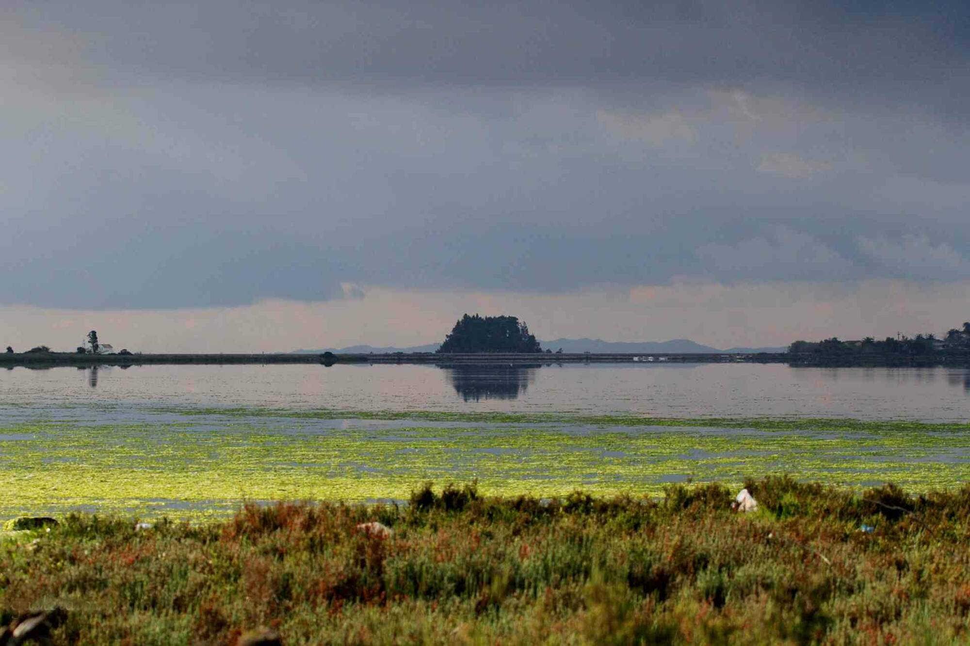
Lefkadas's Straits Lagoons and Alykes (Salt Works)
Although this area is treated as a separate site, in a wide sense, it could be considered as a part of an extensive wetland, together with the neighbouring sites of Amvrakikos Gulf and the lake of Voulkaria. The majority of the information regarding the habitats and flora of this site concerns the island of Lefkada and the study of its continental part (Prefecture of Aitoloakarnania) is expected to increase the known biodiversity and hence the ecological significance of this site. Among the main characteristics of the site which obviously must be taken into consideration, in order to formulate appropriate management programmes, the following should be mentioned: 1) its proximity to the city of Lefkada (around 15,000 inhabitants and several thousands more during the summer); 2) its proximity to one of the three main and more fertile regions of the island; 3) the extensive shellfish aquaculture which takes place within the site. Source: Natura2000 viewer, European Comission.
Location
Lefkada
Coordinates
38.84160843 - 20.69841318
In the waterfalls of the Nymphs
In the waterfalls of the Nymphs: Nymphs - Waterfalls of Nymphs
The walker’s orientation and safety is solely their responsibility. The present report, the relevant tracks (gpx) and the rest of the informational material are just supplementary. The proper equipment is necessary, depending on the weather conditions and the nature of the route.
Route’s type: mixed (there is the linear option too)
Route’s duration: 2 hours
Route’s length: 5.800m
Level of difficulty: difficult (the linear option is easy)
Suggested season: All seasons, if weather conditions permit it. At the circular route, the walker must avoid the winter season.
The route
The route starts from the central square of the settlement of Nymphs and we follow the direction to the settlement of Episkepsi. After passing the stadium and after a two (2) kilometers walk we reach the waterfall. From the asphalt road, a well-maintained path leads us to the root of the waterfall in a particularly delightful landscape. The hiker returns via the same road. From the settlement of Nymphs to the start of the path down to the waterfall, the route can also be done by car.
However, walkers with good physical condition and special experience can continue along the road towards Episkepsi and after one thousand five hundred meters (1,500) they can turn west towards the dirt road where they will follow a steep downhill road, through olive groves, to the ravine. At a certain point the dirt road ceases to exist and the trail is particularly difficult to follow. This part of the route is actually done via an ungraved and unmarked path which requires experience of orientation and skills (this part of the route does not exceed 400 metres). This is to complete the route in a circular route (and obviously there is always the option of a linear route as mentioned initially).
After about four hundred (400) meters of wandering in the ravine and olive groves (in a north -northwest direction) we meet a dirt road that we follow in a west-southwest direction which leads us to the main road near the stadium. The total length of this route is nearly six (6) kilometers.
On the island of Corfu there are:
Citizen Service Centres in the settlements (from north to south): Sidari, Acharavi, Kassiopi, Ypsos, Paleokastritsa, Corfu Town, Achilleion, Moraitika, Argyrades and Lefkimmi.
Police stations in the settlements (from north to south): Karousades, Paleokastritsa, Corfu Town and Lefkimmi.
Numerous private medical practices, medical centres and pharmacies, while public health structures exist (from north to south), Avliotes Regional Medical Centre, Acharavi Regional Medical Centre, Agios Athanasios Health Centre, Hospital and Emergency Centre in Corfu Town, Lefkimi Health Centre.
Nymphs
The fairies gave their name to this settlement, after decorating it with fairytale beauty and choosing it to inhabit! It is located in the northern part of Corfu at an altitude of 200 meters in the western district of the municipality of Thinalio and has 635 inhabitants. It is built on the side of a small valley, through which the waters of the source of the Nymphs flow. It is surrounded by tall cypresses and olive groves, oaks and holly trees. The route to Askitario, which is located just outside the settlement, is unique. Legend has it that an ascetic, Father Artemio Parisios, came to Nymphs in the 5th century AD, was fascinated by the forest and dug the cave with his own hands so that he could calm down and pray. A little above the ascetarium is the first Agricultural School of Corfu built in 1932 and on the ground floor is the old olive press. The walker is accompanied by the chirping of birds and the sound of waterfalls. A big amount of water was necessary in order for the twenty-one water mills of the area to operate! Today the ruins of some of them still remain near the settlement.
It is believed that the area was inhabited since antiquity. In official documents it appears for the first time in 1347, as Nifes, in the founding document of the temple of Pantokrator. The Venetians, because of the important position of Nymphs, had set up a command post there, to supervise and protect the wider area. The architecture of the settlement bears witness to its history.
The famous kumquat, brought by the English agronomist Merlin in 1924, thrives in the area. The Cooperative's factory is also located here. On the premises you can learn all about the production of the sweet and liqueur and of course taste and buy this traditional product.
Every year, on the Sunday of Tyrofagos, in the church of Agios Konstantinos, a particularly interesting ceremony is held, the "Dance of the Priests" (O Horos ton Papadon). During the performance of the event, the senior priest drags a slow dance, followed by other priests and laity. He is the first to sing each verse of the chant, which is repeated by the others in the chorus. This event is observed with some minor variations in the villages of Episkepsi and Klimatia. As to its origin, some scholars claim that it dates back to pre-Christian times.
Nymphs Waterfall
The waterfalls of Nymphs are not the only ones in Corfu. There are others too, but these are the most impressive. Rushing waters fall from a height of about ten metres into a green gorge. This is where legend has it that nymphs bathe. A short distance away are two smaller waterfalls that usually don't even run dry during the summer.
Location
Corfu Island
Trekking route
Coordinates
39.75080612 - 19.80542265
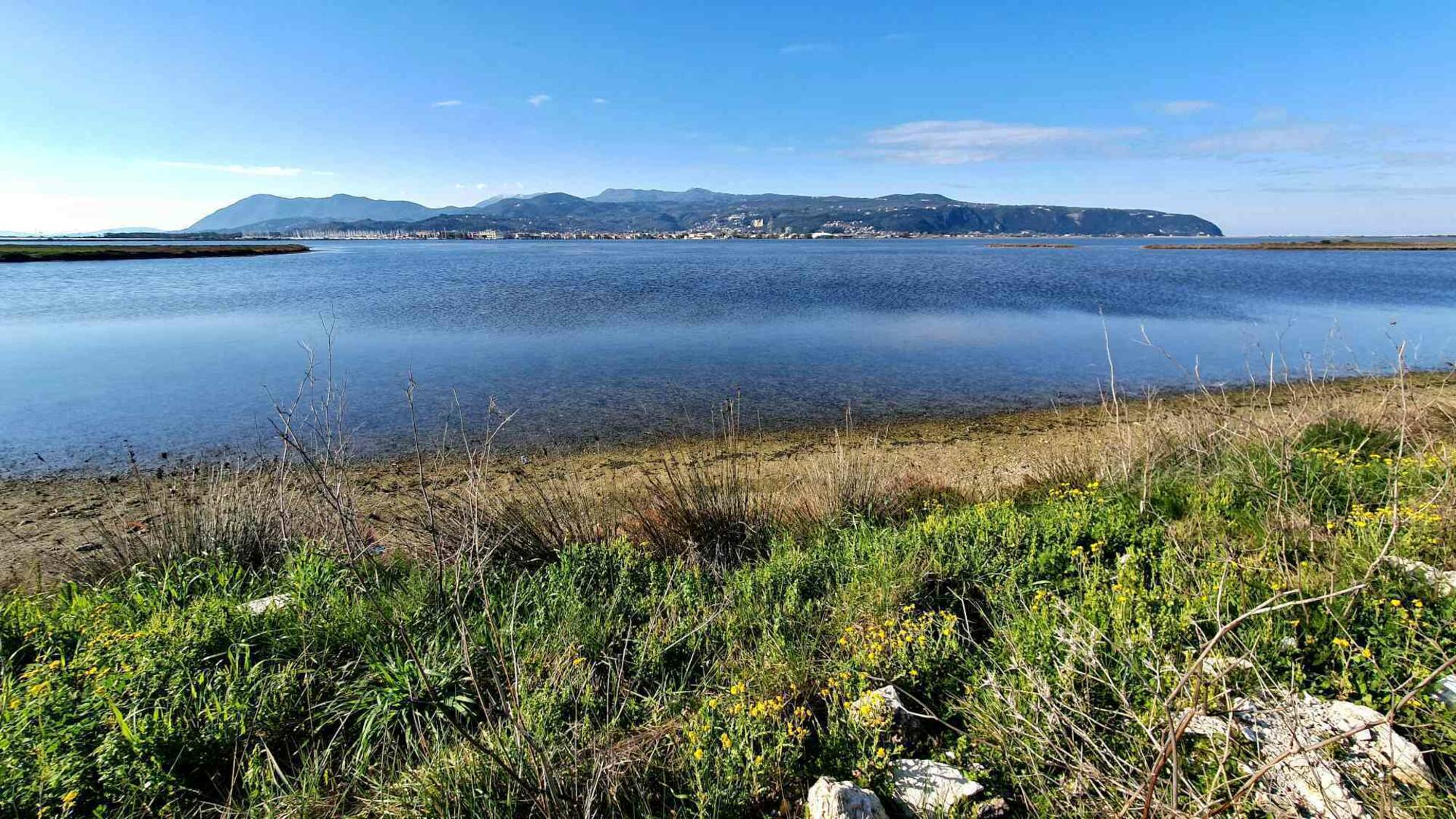
Laganas Bay (Geraki cape - Keri) and islets of Marathonisi and Pelouzo
The site includes Laganas Bay and the islets of Marathonisi and Pelouzo on the south coasts of Zakynthos Island. The inner shallow part of the bay (15 m max) is covered by sandy substrate (16% of the area).
Posidonia meadows cover a considerable proportion of the middle part of the bay, developed at a depth range of 10 to 40 m (27% of the area). Rocky reefs cover only 9% of the area, and are mainly located around the islets of Marathonisi and Pelouzo and the eastern and southern limits of the Bay. The outer limits of the Bay reach a maximum depth of 110m (approximately).The coastal zone of Laganas presents high biological significance because of the occurrence of highly important habitats like sandy beaches with psammophytic plant associations, rocky coasts, coastal lakes, river outlets, etc. In these biotopes characteristic and sometimes unique plant and animal associations grow. In the beach of Marathonisi lowland sand-dunes exist which in some areas present extensions to the inland up to 50m. Beyond the beach, dense Mediterranean vegetation occurs (macquis vegetation). The coastal zone of Laganas is extended for some kilometres inland and 10-15 kilometres in the sea and it is considered as a site with high biological importance exactly because of the presence of biotopes as sandy beaches, sea cliffs, coastal lakes, tidal rivers, etc. The area of this site became well known for two main reasons: 1) the sandy beaches of the sites are considered the main egg-laying sites of the Sea Turtle (Caretta caretta) in Greece, and maybe the Mediterranean as a whole, and 2) the contradictions between the ecologists who suggest the protection of the area and a proportion of the local population which support tourist development of the area, by hotel building, etc. Source: Natura2000 viewer, European Comission.
Location
Zakynthos
Coordinates
0 - 0
Diapontia Island Complex (Othonoi, Ereikousa, Mathraki Kai Vrachonisides)
Three inhabited and five uninhabited small islands, covered mainly by conifers, tall maquis and olive groves. Othonoi islands has extensive sea cliffs and rocky slopes (max. altitude 385 m.) Most of the
uninhabited islets are covered by low vegetation on a rocky substratum, ideal for nesting seabirds. Source: Natura2000 viewer, European Comission.
Location
Coordinates
39.84193174 - 19.40401196
Costal Marine Area from Argostoli gulf to Vlahata
The proposed site covers the marine area from the entrance of Argostoli Gulf and expands towards the village of Lourdata, following the coastline and Mounda Bay to the south-east point of the island. The sea bed has a smooth inclination and the substrate is sandy with a small amount of limestone rock. On the limestone rocks distinctive zones of Cytoseira crinata and calcareous Rhodophyceae dominate. Additionally, large amounts of the Rhodophyceae Laurencia papillosa and the Chlorophyceae Dasycladus vermicularis cover a substantial portion of the hard substrate.Source: Natura2000 viewer, European Comission.
Location
Kefalonia Island
Coordinates
0 - 0
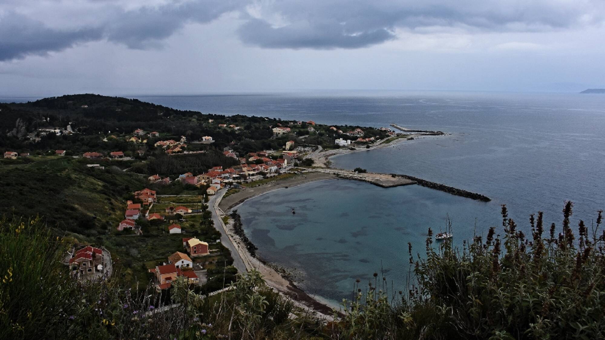
In Othoni
The route
Othoni, provides a dense network of paths of all kinds, paved, cobbled streets, concrete, earthy, etc., which leads to all of the parts of the island and the beaches. In combination with the low traffic, their rich nature and the low altitudes, it is an ideal place for hiking. Therefore, each walker can configure his own route as he wishes. In this sense, the presented route is indicative.
The route starts from the coastal road of Ammos, which turns north - northwest, where after about 150 meters the path that leads us to Stavros begins. The trail is gently uphill in a lush environment, easily visible and there are informative wooden signs.
Going uphill, we see the view from the whole island, while on our right hand is the area of Argyratika, not long after Pagalatika. Shortly after we meet the road, which we follow for about 90 meters, we find the path again where Stavros is less than 500 meters away. From Stavros, if we wish, we proceed towards Daphne and/or Chorio, otherwise we head east along the road to Damaskatika. Following the quiet road we will meet a junction on our left hand towards the beautiful beach of Fiki (the beach is about 1,500 meters from the junction and the way back is somehow uphill - altitude difference of 150 meters).
From Damaskatika, we descend south towards Ammos and the port. The path is actually a narrow concrete road that is mostly downhill. The walker will encounter several intersections before reaching the beach, so following the route requires attention.
The island has a Regional Medical office and a Police Station.
Othoni
Othoni is located at the westernmost point of the country. It is the largest of the Diapontic Islands, located north of Corfu and belonging to the Ionian Islands Region. It has 393 inhabitants (2011) and it is divided into 2 areas (Ano and Kato Panda).
The first name of the island according to ancient texts (Hesychius, 3rd century BC) was Othronos. It was also called Fidonisi, because of the many snakes it had, and Phanos, because of its lighthouse. According to mythology, in ancient times it was Ogygia, the island of the nymph Calypso. Odysseus fell in love with her and stayed with her for seven years.
The island was conquered by the Franks (in the 11th century) and the Venetians (in the 12th century), while, at the same time, it was often attacked by pirates. In 1537, the famous pirate Hayreddin Barbarossa massacred the island's inhabitants. According to tradition, the event is commemorated by the white stone cross of 1833 on the Kalodiki hill. In 1815, the English conquered the Othonians. With the treaty signed in 1864, the Ionian Islands - and with them the Diapontia Islands - passed permanently to Greek sovereignty.
In the west of the island, near the beach of Aspri Ammos (access is available only through private boats), there is the Cave of Kalypso, 100m long, 10m wide and 20m high and the old churches of Agia Triada (late 17th century), Panagia (17th century), Agios Georgios and Agia Paraskevi. At the northeastern edge, at cape Kastri, at the top of the hill at an altitude of 100m, near the ruins of the venetian fortress, there is the lighthouse of the island. It was built in 1872, it is 13m high and it is the first lighthouse that those sailing from the north to the Ionian Sea encounter.
The main occupations of the current inhabitants are tourism, fishing and olive oil production. The island is full of olive trees which produce the olive oil, with a high content of high quality oil. Most of them are over 300-400 years old and more than seven metres high. There are also cypress trees on almost all the mountain slopes and many fruit trees. The tall mulberry (or Skamnia) and fig (or Skeria) trees are found in almost all the districts and gardens. Oregano, sage and many other herbs thrive. There are also several rabbits and wild rabbits. The common form of reptile is a kind of viper.
Othoni is one of the first stations of migratory birds in southeastern Europe from Libya, especially of warblers. Among marine mammals: the bottlenose dolphin and at least three species of sharks (including the well-known great white shark) have been observed, while occasionally, near the cave of Kalypso, movements of monachus monachus mediterranean monk seal are also observed. The zooplankton in the small bays of the island and especially in Fiki is so abundant that at night, when there is tranquility, it literally illuminates the seabed.
The local festival takes place on 15 August, on the feast of Panagia.
.JPG)
Western Coastal Zones of Kefallonia
The coastal zone starting from the middle of the Kefallinia - Ithaca channel and extending to the SW of Kefallinia (Cape Gero Gompos) and the N. Ithaca (Cape Drakou Pidima) is an important area for the
Mediterranean Monk Seal, several ceatacean species and the loggerhead turtle (Caretta caretta). The zone extends from the 200-isobath to a narrow terrestrial band of 50m width. The site comprises extended Posidonia beds (Posidonion oceanicae) in very good conservation status, large shallow inlets and bays, marine caves and sea cliffs. Source: Natura2000 viewer, European Comission.
Location
Kefalonia Island
Trekking route
Coordinates
38.18009683 - 20.34165204
Coastal area between Kanoni and Mesoggi villages
The area is located in the east part of Kerkyra Island including the coastal sea area between Kanoni and Mesoggi villages. In the area of Kanoni the water is shallow, and little exposed with smooth rocks at a
depth of 0.5 m, and a few fairly secluded pools. The rocks are psammitic. Among the upper rocks the marine phanerogam Cymodocea nodosa grows on sandy substrate. The beds of Posidonia oceanica
expand at depths below 1.5 m southwards to Mesoggi. In this area the sea bottom is stony and sandy with stones and rocks of all sizes. The Phaeophyceae predominate while the dominance of the
Cystoseiretum crinitae community. Source: Natura2000 viewer, European Comission.
Location
Corfu Island
Trekking route
Coordinates
39.59768438 - 19.90739332